¶ How to import LiDAR Data
¶ Prerequisites
- Train Sim World PC Editor
- QGIS
- Some LiDAR data
¶ Preparing the data for the editor
All LiDAR data imported into the TSW Editor must be in the ASCII raster (.asc) format and in the EPSG:3857 projection with a pixel size of 1. Most data available does not come in this format so it must be reprojected (warped) into the correct projection using a tool like QGIS.
¶ Steps for preparing data in QGIS
- Open QGIS and create a new empty project.
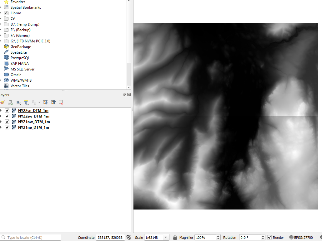
- Drag the lidar files into the window, it should import them. I’m using GeoTiff files but loads of formats are supported.
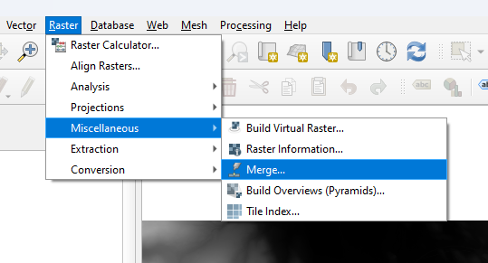
- In this case there are many files and not just one, so I merged them all into one by selecting Raster->Miscellaneous->Merge.
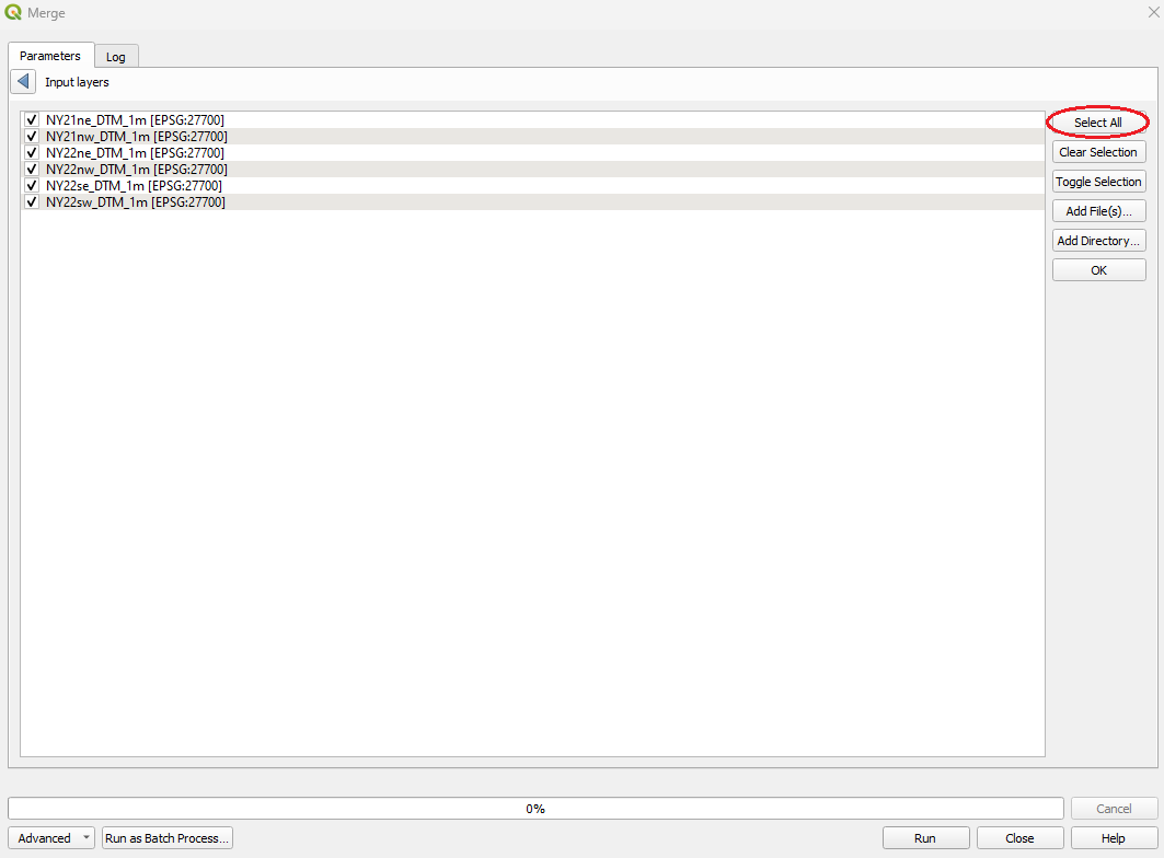
- Then selected all layers under ‘Input layers’ and Clicked ‘Run’.

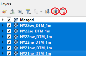
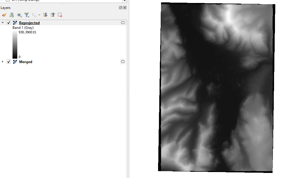
- The merged layer should now appear in the ‘Layers’ section and the other layers can be removed.
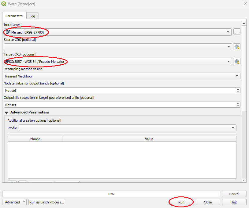
- The merged layer then needs warping to the correct projection by selecting Raster->Projections->Warp.
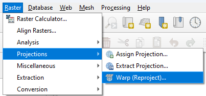
- The target CRS must be EPSG:3857 – Pseudo-Mercator
If this is not an option press the world icon to search for it


- Click run to create the new reprojected layer.
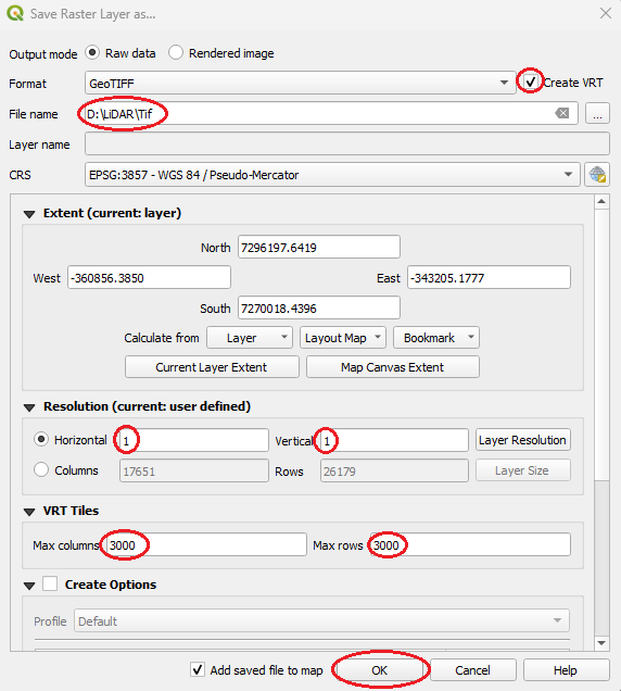
- Then right click on the Reprojected layer and select Export->Save As…
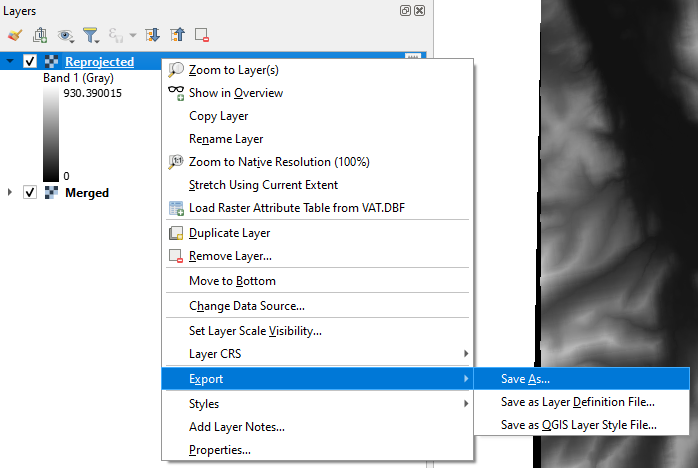
- Tick ‘Create VRT’.
- Under ‘File Name’ select a folder to save the files in
- Under ‘Resolution’ both Horizontal and Vertical should be set to ‘1’
- The values under ‘VRT Tiles’ should be set to something reasonable such as ‘3000’.
- Select ‘OK’
- The folder previously selected should now be filled with GeoTiff files all in the correct projection for the editor. These all now need converting to .asc files.
- Remove all existing layers open in QGIS
- The folder where the 'Reprojected' layer was saved to should now contain many GeoTiff files. Preview them in file explorer and the delete the ones that are blank/black.
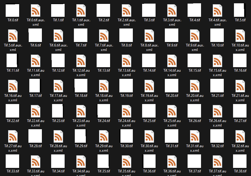
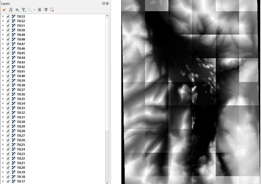
- Import all the .tif files from this folder back into QGIS (Ignoring all XML files and the VRT file).
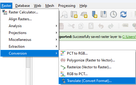
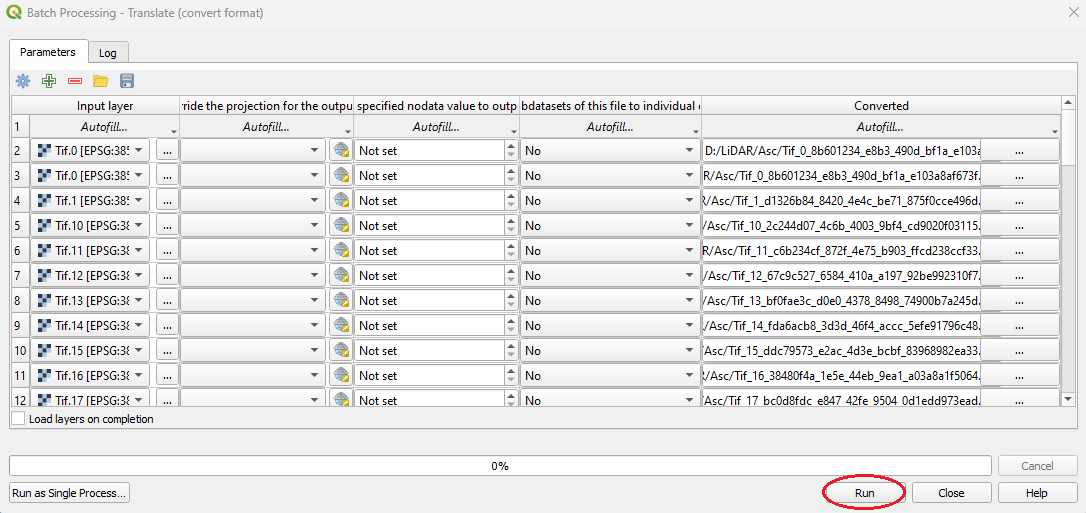
- Now select Raster->Conversion->Translate.
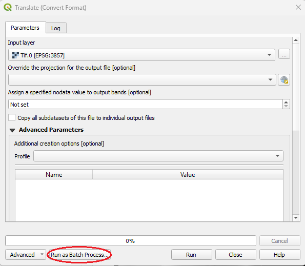
- Press ‘Run as Batch Process…’ on the bottom left of the window.
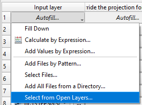
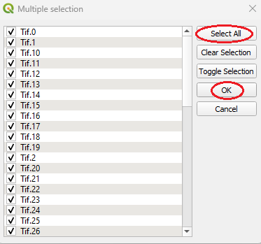
- Under ‘Input layer’ select ‘Autofill…’ and then ‘Select from Open Layers...’ select all the layers.
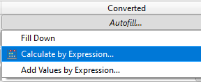
- Under ‘Converted’ click ‘Autofill…’ and select ‘Calculate by Expression…’
- Create a folder to hold all the .asc files (In file explorer)
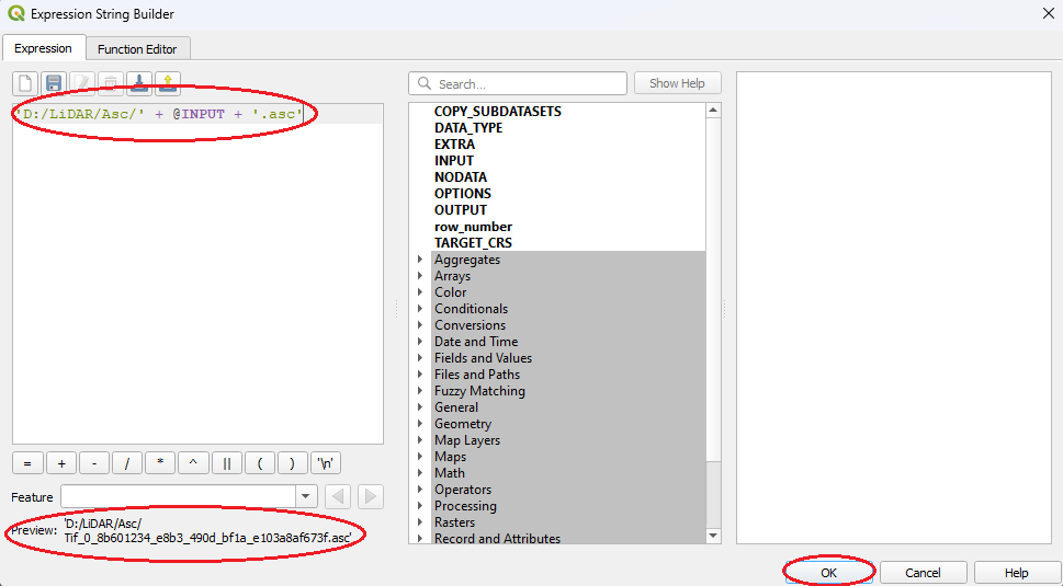
- Adapt this expression for where the files should be saved:
'D:/LiDAR/Asc/' + @INPUT + '.asc'
- Then hit run.
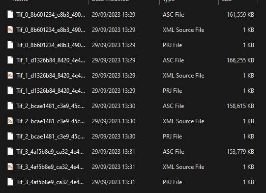
- The folder will now contain a load of .asc files that can be imported and used in the TSW editor.
¶ Importing the prepared data into the editor
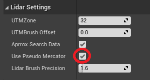
Ensure the 'Use Pseudo Mercator' box is ticked when importing LiDAR data.
Stream showing how to import prepared data:
https://www.youtube.com/live/zNWuhovnLtI?si=IHk1-6Z6SpIO3ELY&t=846
¶ LiDAR Resources
- OpenDemSearcher Map with links to a few datasets
- Austria (10m)
- Austria (1m)
- Belgium - Wallonia
- Belgium - Flanders
- Denmark
- Estonia
- France
- Germany - Bavaria
- Germany - Brandenburg
- Germany - North Rhine Westphalia (1m DGM)
- Germany - North Rhine Westphalia (1m DOM)
- Germany - Sachsen-Anhalt (1m Tiles)
- Germany - Sachsen-Anhalt (1m Chunks)
- Germany - Schleswig-Holstein
- Germany - Saxony
- Germany - Lower Saxony
- Luxembourg
- Netherlands
- Norway
- Poland
- Spain
- Sweden (LAZ)
- Switzerland
- USA
- United Kingdom
¶ Useful links
https://forums.dovetailgames.com/threads/lidar-tutorial.74374/#post-727093 - Similar tutorial